Published May 24, 2019
The Great Lakes are a living, breathing system. They are dynamic and constantly changing, evolving over time. So, it makes sense that water levels continuously rise and fall and have been fluctuating dramatically since the formation of the Great Lakes.
1
Water levels in the lake naturally go up and down
Not only do water levels change over centuries, but they also fluctuate between seasons and within a single day. Along the shoreline, the water level may appear to change quite significantly throughout the duration of a day. Most of these changes give the lakes the appearance of a tide, but are actually caused by seiches. Learn more about Great Lakes and their tide-like patterns.
2
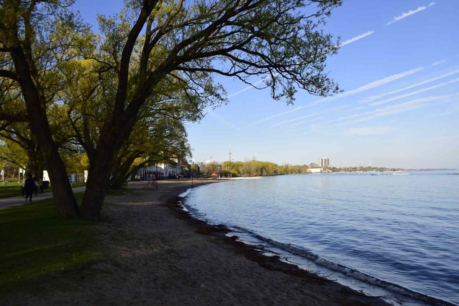
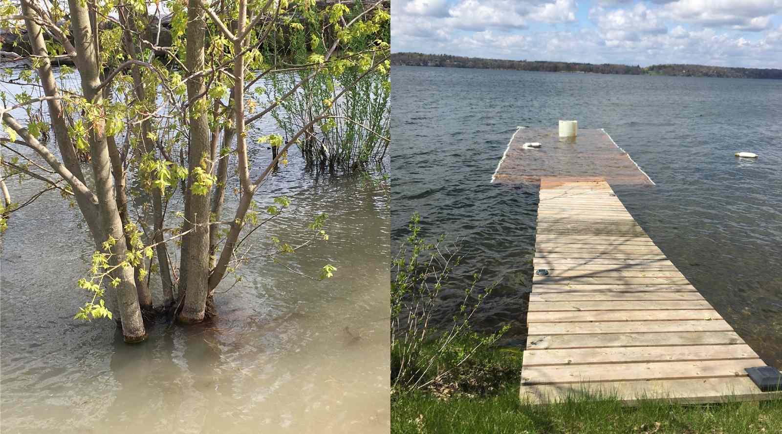
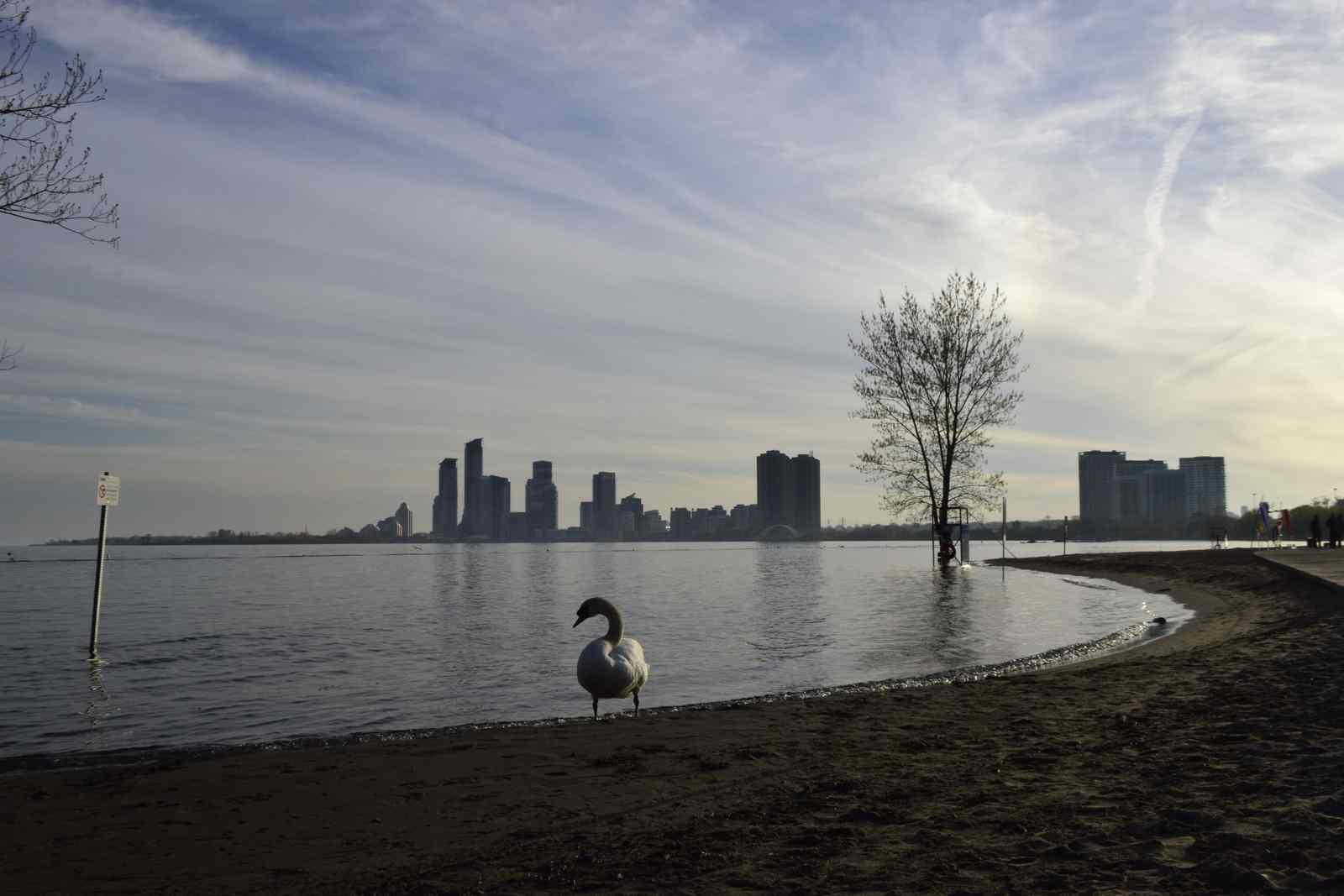
In our lifetime, we are experiencing the highest water levels on the Great Lakes in 2020
Annual or seasonal fluctuations in water level are primarily caused by precipitation and nearby runoff. Water levels in the lakes can increase drastically if there is a significant amount of precipitation or land runoff. They can decrease drastically with low levels of precipitation and increased evaporation. Average water levels continue to rise across the Great Lakes, with many nearing or exceeding past record high levels.
3
Great Lake water levels are higher in the spring and lower in the fall
In the spring months, the snow and ice begins to melt and drain into the lakes. By June and July, water levels are at their highest. When August hits, the weather warms along with the lakes’ surface water. This results in increased evaporation and water levels begin to fall once again.
4
Fluctuating water levels actually creates fish habitat
Naturally fluctuating water levels are a sign of a healthy lake. Wetlands benefit from periodic high and low water levels, which create conditions for healthier and more diverse plant habitats, and improve water quality so wildlife can thrive.
5
Lakes Superior and Ontario are the only Great Lakes with controlled outflows
The water levels within each Great Lake are determined by how much water flows in and out of the lake. These are influenced by long-term natural trends in precipitation and evaporation.
The levels of lakes Superior, Michigan, Huron, and Ontario are also influenced by dams in the St. Marys River and St. Lawrence River that control the outflows from lakes Superior and Ontario. The International Joint Commission (IJC) regulates the outflows to balance how water levels affect upstream and downstream interests in Canada and the United States.
To learn more about how water flows into the lakes, read about the Great Lake Watersheds and the IJC's regulation of Lake Superior and Lake Ontario.
6
You can see Great Lake water levels in real-time
Hourly water gauges are in place all around the Great Lakes, in both the U.S. and Canada. The U.S. data can be accessed through the NOAA, and the Canadian data through Fisheries and Oceans Canada.

Have you been down to your nearest waterfront lately? Send us pictures @greatlakesguide and using #greatlakesguide, or submit them through the Swim Guide app.